Correction of Digital Elevation Models using drainage pattern constraints
Pierre Aurousseau, Professor
at E.N.S.A.R. and Hervé Squividant,
Information Technology Engineer
Laboratoire de Spatialisation Numérique, E.N.S.A.R.,
65, rue de Saint Brieuc,
35042 Rennes cedex, France
1. Introduction
Digital Elevation Models are numerical databases that comprise a set of uncertainties or errors. For DEMs with steps of 20-50 m, the elevation errors are of the order of one metre up to several metres. Some producers of DEMs give the specifications of the altimetric databases that they are marketing, either by defining a mean quadratic error (e.g. less than 3 m) or by establishing a maximum error bracket (e.g. maximum amplitude less than half the interval between successive contours for DEMs produced by interpolation of height contours).
Elevation errors are the cause of the different drawbacks encountered with the utilization of DEMs: drainage anomalies, positionning errors in modelled drainage networks and errors in modelling the boundaries of catchment basins/sub-basins.
In the present study, improvements in the
quality of DEMs obtained using corrections based on drainage pattern constraints
are discussed in the light of several criteria: drainage anomalies, quality
of the spatial estimation of the drainage network and the boundaries of
catchment basins or sub-basins.
2. Processing method
2.1. Drainage anomalies
The presence of drainage anomalies is one of the problems encountered when generating a drainage network by DEM processing.
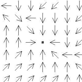
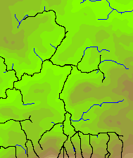
A drainage anomaly is defined as an enclosed site (i.e. surrounded by eight cells that are all higher than the central cell) (Fig.1). This type of situation is not usually encountered in nature except under special environmental conditions, i.e.: karst areas, closed drainage systems and moraines.
Drainage anomalies are observed in particular along or near watercourses in valley bottoms, being the consequence of errors present in the DEM. It is known that errors in DEMs are especially well represented on valley bottoms and along ridges (watersheds), whereas uncertainties in height are mostly very small on the valley sides within the river basin.
For DEMs with widely spaced grid steps (of the order of 250 m and 500 m), the number of anomalies is in the range 300-500 for 10,000 grid cells, which corresponds to about 40,000 anomalies out of a total of 1 million cells. For DEMs with steps of 20-50 m, there are 30-100 anomalies per 10,000 cells (i.e. about 5,000 anomalies per million cells).
Thus, the number of anomalies to be corrected
is often very high in the case of large-scale DEMs. This correction step
is essential before modelling the river system or the drainage pattern
2.2. Extraction of a modelled drainage
pattern
Any cell of the DEM is considered to belong to a given river system if the surface of its catchment area is larger than a certain threshold value. Taking account of the lithologies (shales, sandstones and granites) and rainfall distribution observed in Brittany, the permanent drainage pattern is characterized by a very finely divided stream system. To model this pattern (Seemuller 1989; Meisels et al. 1995), a catchment surface threshold of the order of 20-25 hectares is considered appropriate for areas of heavy rainfall in western Brittany (more than 1,000 mm annual precipitation), while a threshold of about 50-70 hectares is selected for areas of lower rainfall in eastern Brittany (600-1,000 mm annual precipitation). The estimated or modelled drainage pattern is a sub-set of the monodirectional drainage tree, and can show local discrepancies with the real drainage pattern.
In most cases, the modelled drainage pattern is very similar to the real river system; although it follows the watercourse along certain reaches, it sometimes shows a divergence from ground observations.
In flat-bottomed valleys, the modelled pattern may appear to loose its way on the flood plain and wander away from the real drainage system. When the real system exhibits meanders, the modelled pattern commonly intersects the meanders.
By contrast, in v-shaped valleys, the modelled pattern can lie very close to or overlap with the real drainage system. In this way, the modelled pattern often shows a better quality in secondary valleys than in the wide main valleys with relatively flat bottoms.
Artificial river captures may be generated
by the modelling of a drainage pattern. These artefacts may clearly be
produced in either direction; a drainage pattern may loose some tributaries
and gain others (Fig. 2).
In this context, it is reasonable to carry
out correction of DEMs using the constraint of a vector layer related to
the drainage pattern. The following steps may be followed :
1) Acquistion of a geographical information layer concerning the drainage pattern in vector mode, using an adequate resolution consistent with the resolution of the processed DEM. For a DEM with a grid step of 20 m, the vector layer is obtained from a map on a scale of 1:25,000 and digitized with a resolution of the order of 10 m. For a DEM with steps of 40 or 50 m, it is sufficient to build up the vector layer from a map on a scale of 1:50,000.
2) The vector layer is imported into the DEM by rastering, thus generating a binary raster layer consistent with the DEM (1 is used if the drainage pattern is to be projected into the DEM grid, 0 is used if not).
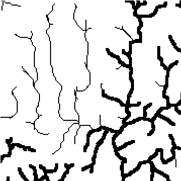
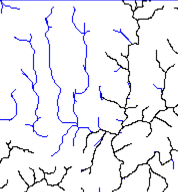
3) A prelimiary comparison can be made between the real and modelled drainage patterns (Fig. 3).
4) It is then possible to observe that the DEM height values do not display an ordered distribution along the drainage system (i.e. they do not increase monotonously) (Fig. 4).
5) Corrections are performed on those heights
of the DEM grid that are projected onto the drainage pattern. Although
several methods can be employed, only two were implemented in the present
study.
2.3. Correction based on constraints
using tree-search method
The first method used here consists in
extending the concept of sorting within a segment to sorting through a
tree structure. To achieve this, the following procedure is applied:
1) The elevations of DEM grid cells that are projected onto the drainage pattern are loaded in the form of a vector.
2) Grid cells belonging to the drainage pattern are then sorted according to two criteria. The first criterion is the order of appearance of cells during an upstream search of the tree representing the drainage pattern. A sorted list of cells is thus built up based on this criteria.
3) The second criterion for cell sorting is elevation. A second list of grid cells is thus established on this basis.
4) The final step involves merging the
two lists; the lowest elevation corresponding to the the first cell of
the second list is attributed to the first cell of the first list, on so
on up to the highest elevations .
Fig. 5 .
2.5. Correction based on constraints
using a virtual cutting method
This method arises from (is based on) the
inspection of results obtained from the tree-search method. The technique
of re-assigning elevations described in the previous section leads locally
to the raising of grid cells belonging to the drainage pattern with respect
to their immediate neigbours. The chosen solution for overcoming this effect
makes use of the following procedure:
1) The vector layer is imported into the DEM by rastering, generating a binary raster layer consistent with the DEM (using 1 if the drainage pattern is to be projected into the DEM grid, 0 if not). In fact, this procedure does not simply consist of rasterization since it generates a tree structure in the memory that controls the logical relation "receives input from".
2) The drainage pattern tree is thus constructed starting from the downstream outlet of the system.
3) Local minima are identified through a tree-search path procedure along the drainage network and denoted as "m".
4) Downstream from each local minimum "m", the first grid cell belonging to the drainage pattern having a lower elevation than the local minimum is denoted "i".
5) Proceeding downstream along the tree, the elevations of cells between each local minimum "m" and the next cell "i" are corrected in such a way that they decrease monotonously, thus creating a virtual cuting.
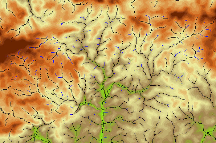
3. Data treated
3.1. DEM with grid size of 20 m or 40
m
The methods described above were applied
on a fine scale ranging from 1:25,000 to 1:50,000, based on a DEM with
a 20-m grid size covering the whole of the Brittany region and a lower
resolution DEM with a 40-m step derived from the first DEM. The 20-m-grid
size DEM for Brittany (135 million grid cells) was drawn up using stereo-generation
from SPOT images. This DEM was acquired from the ISTAR company, a subsidiary
of SPOT Image. The scale used is suitable for the processing of catchments
with surface areas of between 500 and 100,000 hectares.
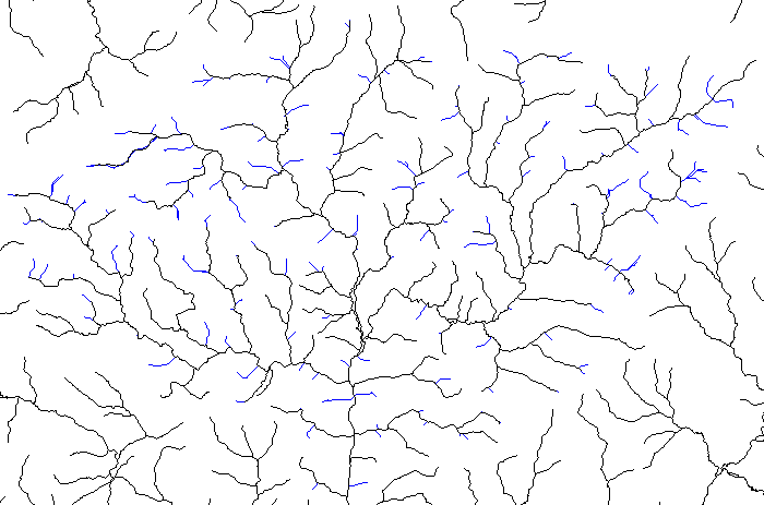
3.2. Drainage pattern represented in
vector mode
The drainage pattern used here is a network in vector mode obtained by digitizing cartographic maps on a scale of 1:25,000. The technology used is as follows: digitizing of the drainage pattern (blue lines) using a large-format scanner with a relatively low resolution of 200 DPI, binary encoding by threshold, skeletoning, geographic matching and automatic vectorization.
The vector data so obtained are very precise;
the control points or intermediate points are separated from each other
on the ground by a distance of less than 10 m. The precision of matching
is better than 10 m. In some areas, very few matching errors are observed
that are greater than about 20 m.
4. Results
4.1. Reduction in the number of drainage
anomalies in a corrected DEM
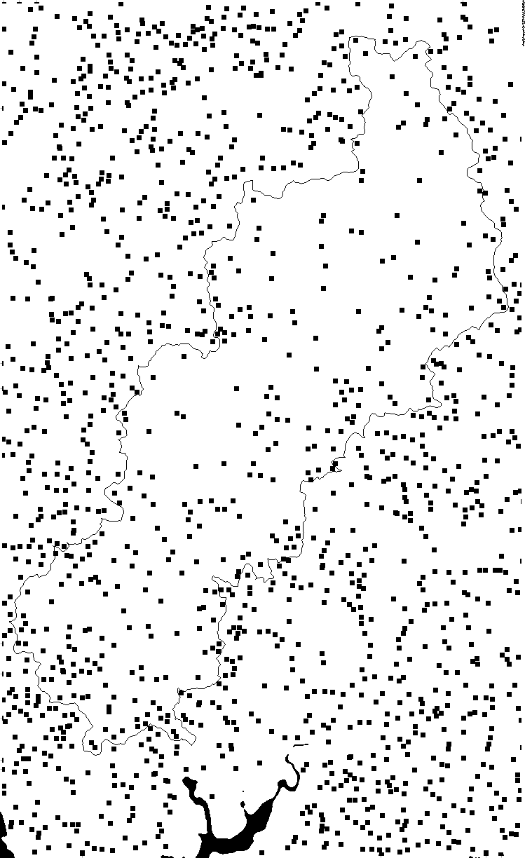
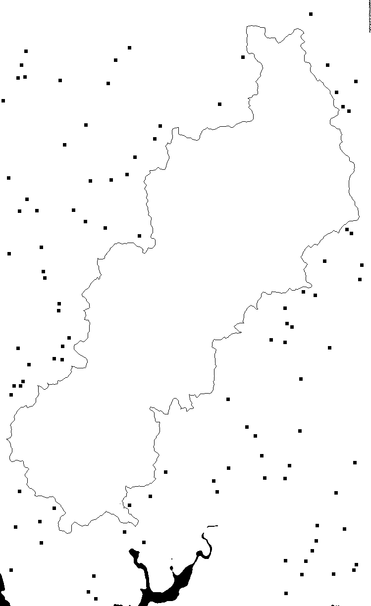
The first result of correcting the DEM
using drainage pattern constraints is a reduction in the number and amplitude
of the anomalies. In the case of the Scorff drainage basin (South Brittany),
the number of anomalies drops from 577 before correction to 282 after (Table
1). Furthermore, the remaining anomalies are of less importance since
they all show amplitudes smaller than 5 m. Before correction, there were
61 anomalies larger than 5 m and the maximum anomaly within the basin attained
a value of 16 m (Fig. 6a, 6b,
6c, 6d, 6e,
6f).
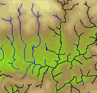
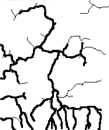
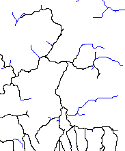
4.2. Consistency between modelled drainage
pattern and real river system
The second result involves the quality
of the the drainage pattern modelled by processing of a DEM after correction
based on constraints. The modelled pattern is consistent with the ground
truth: the modelled river system can be perfectly superimposed onto the
mapped drainage pattern (blue lines)..
4.3. Drainage pattern corrections
The advantage derived from correcting a
DEM is not simply limited to improving its consistency. In fact, the modelled
pattern makes it possible to complement the pattern as described on topographic
maps or in digital geographical data, by contributing a whole series of
corrections and supplementary information.
1) Local omissions are corrected:
The base document derived from the cartographic
database of the Scorff drainage basin shows an interruption in the mapped
drainage pattern over an interval of several millimetres. This omission
leads to a more severe error during digitization:, i.e.: the operator forgot
to digitize the small fragment of drainage pattern situated beyond the
interruption. Indeed, this interruption was interpreted by the operator
as the upstream termination of the drainage pattern, failing to note the
existence of this error and the continuation of the network any farther.
After DEM correction using constraints, the modelled drainage pattern corrected
this interruption as well as the carryover error by naturally connecting
the omitted sub-network to the main pattern (Fig. 7-1,
7-2, 7-3).
In another drainage basin of South Brittany
(Loc'h river system located to the east of the Scorff) a more serious error
is present because the drainage pattern has not been represented over more
than one centimetre on the topographic map. However, the operator became
aware of this error and digitized the upstream sub-network which was unconnected
with the main drainage pattern on the map. Again in this case, DEM correction
using drainage pattern constraints leads to elimination of the interruption
and enables a realistic joining up of the sub-network which was previously
isolated from the main pattern as mapped.
2) Major carryover and digitization errors
are corrected:
In the the Yvel-Hyvet drainage basin of
Central Brittany, a relatively major error is apparent on the topographic
map; the drainage pattern is not represented within an area of 600 hectares
corresponding to a catchment sub-basin, although a permanent drainage pattern
can be observed within the region of Brittany if the catchment area threshold
is set at about 70 hectares. Here again, constrained correction of the
DEM removes the error from the modelled drainage pattern and re-establishes
the sub-network that was absent on the map (Fig.8-1,
8-2, 8-3).
3) Additional information is obtained on
the fine-scale stream system:
In parts of Brittany with the highest rainfall,
the stream system shows an extremely finely divided and well developed
pattern. Ecologists monitoring the natural fish populations in these drainage
systems have observed that the mapped stream traces (blue lines) show far
shorter length than the ground truth. In collaboration with the ecologists,
the present authors have modelled the fine-scale stream system of the drainage
pattern. Modelling of permanent water pattern is achieved in this region
using a catchment area threshold of 20 hectares. The additional information
on the modelled stream system provided by DEM processing corresponds to
XX% of the overall pattern as represented on topographic maps (Figure 9-1,
9-2, 9-3 and table 2).
The drainage pattern modelled in this way
benefits from the different corrections and additional information contributed
automatically by DEM processing. It can then be converted into vector form,
yielding a digital information layer related to the supplemented and corrected
drainage pattern. This layer may have a lower resolution than the vector
layer of the initial drainage pattern, actually depending on the resolution
of the DEM used. Hence, the resolution of the vector layer obtained from
modelling will be either 20 or 40 m according to the DEM used, while the
resolution of the initial vector layer could be better than 10 m.
4.4. Modelling of catchment basin boundaries
After DEM correction using drainage pattern
constraints, the modelling of boundaries of catchment basins or sub-basins
can generate consistent and satisfactory results with no capture artefacts
as described above (Fig. 10 ).
5. Conclusions
The correction of DEMs using drainage pattern constraints appears to be a fruitful approach for improving the quality of the digital data. As a result, this would also enhance the quality of spatial modelling that can be carried out with DEMs. In the present study, we show the different improvements obtained from these corrections when applied to several examples of DEMs with steps of 20 m and 40 m. These improvements not only include various corrections of errors and omissions concerning the drainage pattern, but also involve the modelling of fine-scale stream systems and the contouring of catchment basins and sub-basins.
Figure captions
Figure 1 - Drainage model in proximity to a drainage anomaly.
Figure 2 - Two types of capture in the upstream part of the Scorff catchment basin.
Figure 3 - Comparison between modelled and real drainage patterns.
Figure 4 - Longitudinal profile of a drainage pattern before correction of DEM using constraints.
Figure 5 - Longitudinal profile of a drainage pattern after correction of DEM using constraints.
Figure 6 - Distribution of drainage anomalies after correction of DEM using drainage pattern constraints in the main catchment basin:
(a) all anomalies;
(b) anomalies larger than 1 m;
(c) anomalies larger than 2 m;
(d) anomalies larger than 3 m;
(e) anomalies larger than 4 m;
(f) anomalies larger than 5 m.
Figure 7 - Correction of a local error in the drainage pattern using a network modelled from a constraint-corrected DEM (upper part of Scorff catchment) 7-1, 7-2, 7-3.
Figure 8 - Correction of a major error in the drainage pattern using a network modelled from a constraint-corrected DEM (eastern part of Yvel-Hyvet catchment) 8-1, 8-2,8-3.
Figure 9 - Additional information on fine-scale stream system, obtained from the drainage pattern modelled from a constraint-corrected DEM (upper part of Aulne catchment) 9-1, 9-2, 9-3.
Figure 10 - Automatic correction of catchment
area boundary after correction of DEM using drainage pattern constraints.
Table 1 - Number of drainage anomalies as a function of their elevation:
- over the whole DEM and before correction using constraints;
- in the main catchment basin and before correction using constraints;
- outside the main catchment and before correction using constraints;
- over the whole DEM and after correction using constraints;
- in the main catchment basin and after correction using constraints.
Table 2 - Comparison between linear trace
of the drainage pattern as represented on the topographic map and linear
trace of pattern modelled by DEM processing after correction with constraints.
Layer of digital geographic information
in vector mode, derived from drainage pattern
(resolution < 10 m)
|
DEM with steps of 20 or 40 m
|
DEM correction using drainage pattern constraints
|
Modelling of drainage pattern by DEM processing
(in raster mode)
|
Vectorization of modelled drainage pattern
|
Layer of digital geographic information
in vector mode, derived from drainage pattern
(resolution 20 or 40 m)
but with correction of errors and omissions, plus
additional information on fine-scale stream system
|
Modelling of boundaries of catchment basins and sub-basins
by DEM processing (in raster mode)
|
Vectorization of modelled boundaries
of catchment basins and sub-basins
---------------------------------------------------------------------------
![]()